| Status: | Active, open to new members |
| Leader: | |
| Group email: | Weather and Climate group |
| When: | Monthly on Thursday afternoons 2:00 pm-4:00 pm 1st Thursday afternoon (except August) from 14:00 - 16:00 |
| Venue: | Wembury Village Hall, Knighton Room |
| Cost: | £1.50 per person to cover the room hire |
Have you ever wondered why it rained so heavily, or why the weather forecast was wrong? Do you have a keen interest in the shape and formation of clouds? If so this might be the group for you.
Is our climate getting warmer and wetter? Data are examined to reveal all on the monthly, seasonal and yearly timescale. Each session will be topic based, but will include a discussion of the current weather, previous month’s weather, and the all-important forecasts for the days and weeks ahead.
If any extraordinary weather has occurred, in the context of our usual climate, it will be discussed.
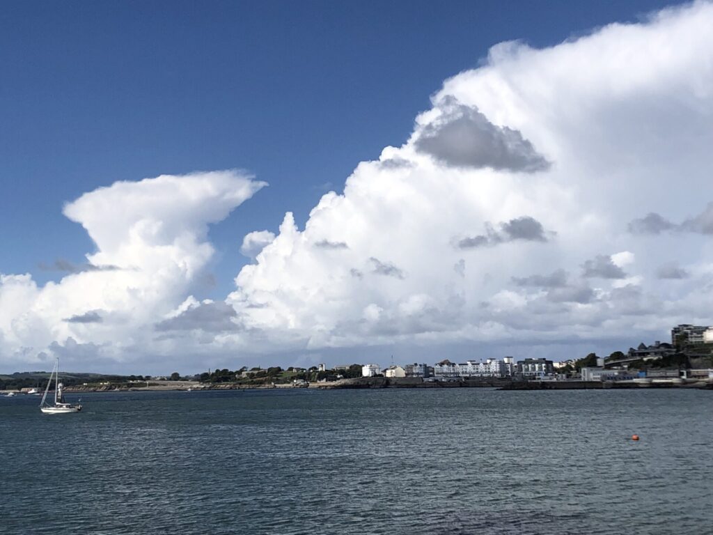
Summer clouds
This photo taken from Wembury shows altocumulus clouds typical of a rather unstable atmosphere which suggests later there will be heavy rain and possibly thunder. This indeed happened.
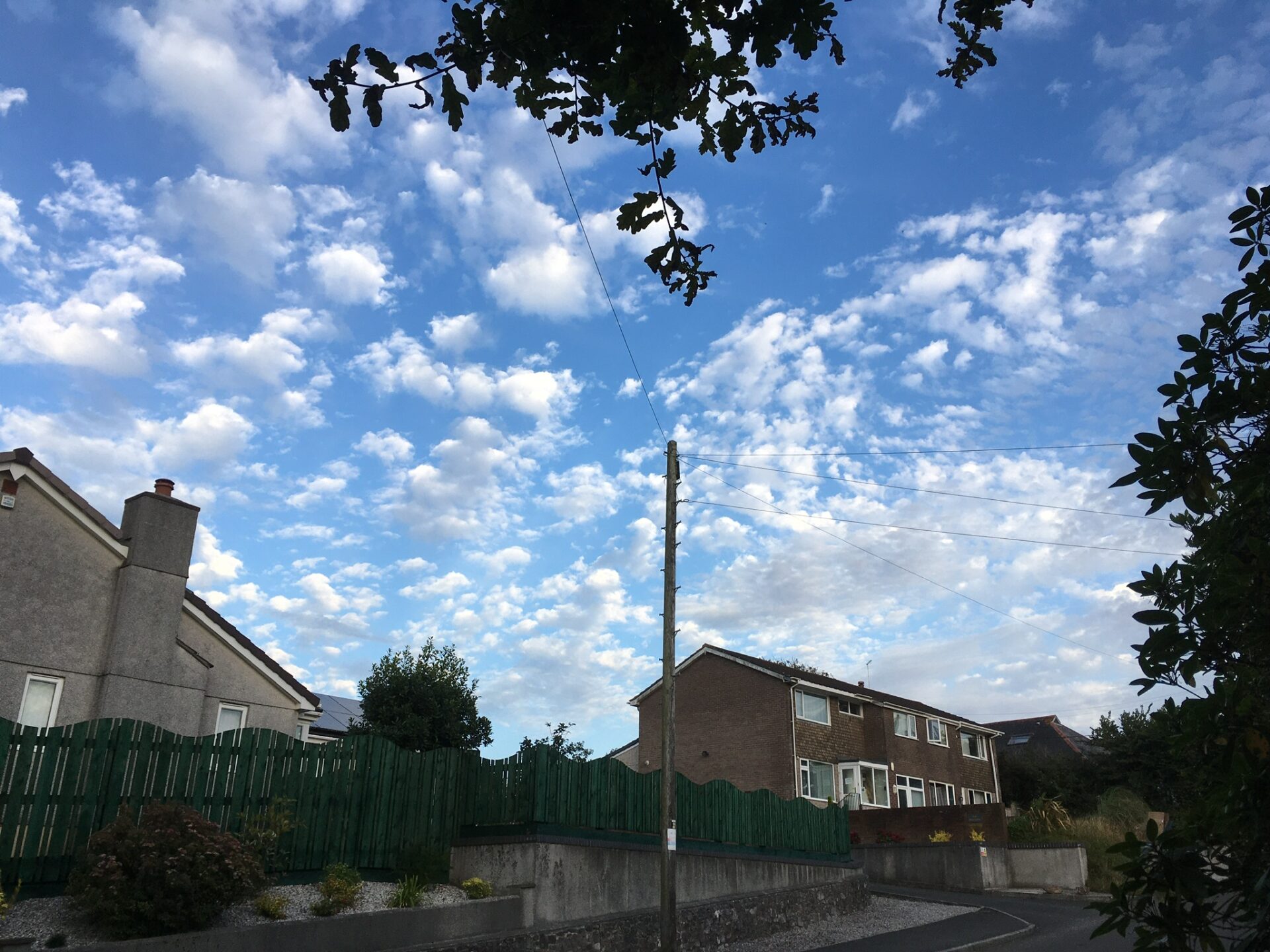
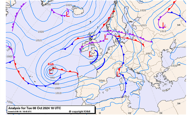
We followed the progress of
ex-Hurricane Kirk which fortunately passed us to the south. However we have still had more than our share of rain and wind in September and October. The rainfall total at the time of writing, 22 October, is 227 mm (9 inches) which is well above average for the time of year.
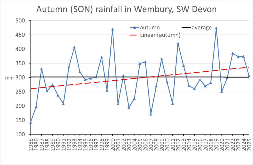
Autumn 2025 rainfall was average according to the 30-yr mean.
However over 40 years autumn appears to be getting wetter.
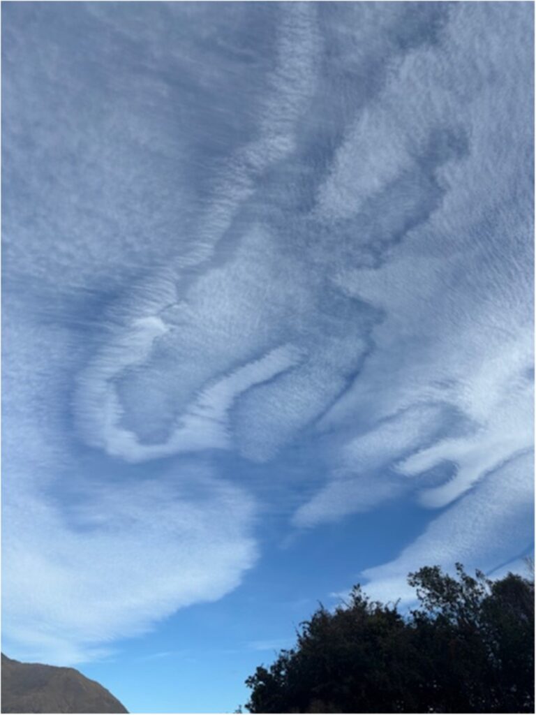
This photo, taken in New Zealand by group member Carole Davison, shows fascinating multi-level clouds. The location is Queenstown which is pretty well surrounded by mountains. These initiate wave motion in the downwind airflow allowing cloud formation in the crests. The darker wave cloud appears to be shaded by a higher cirrostratus layer above.